Brecon Beacons, day 2 / 5
Day 2 of my Brecons walking holiday: climbing Pen Y Fan
15 June 2021
Today I did the big one: Pen Y Fan, the highest peak south of Snowdonia.
I'd done this walk once before, back in March 2019. I took exactly the same route but, as we shall see, there were differences.
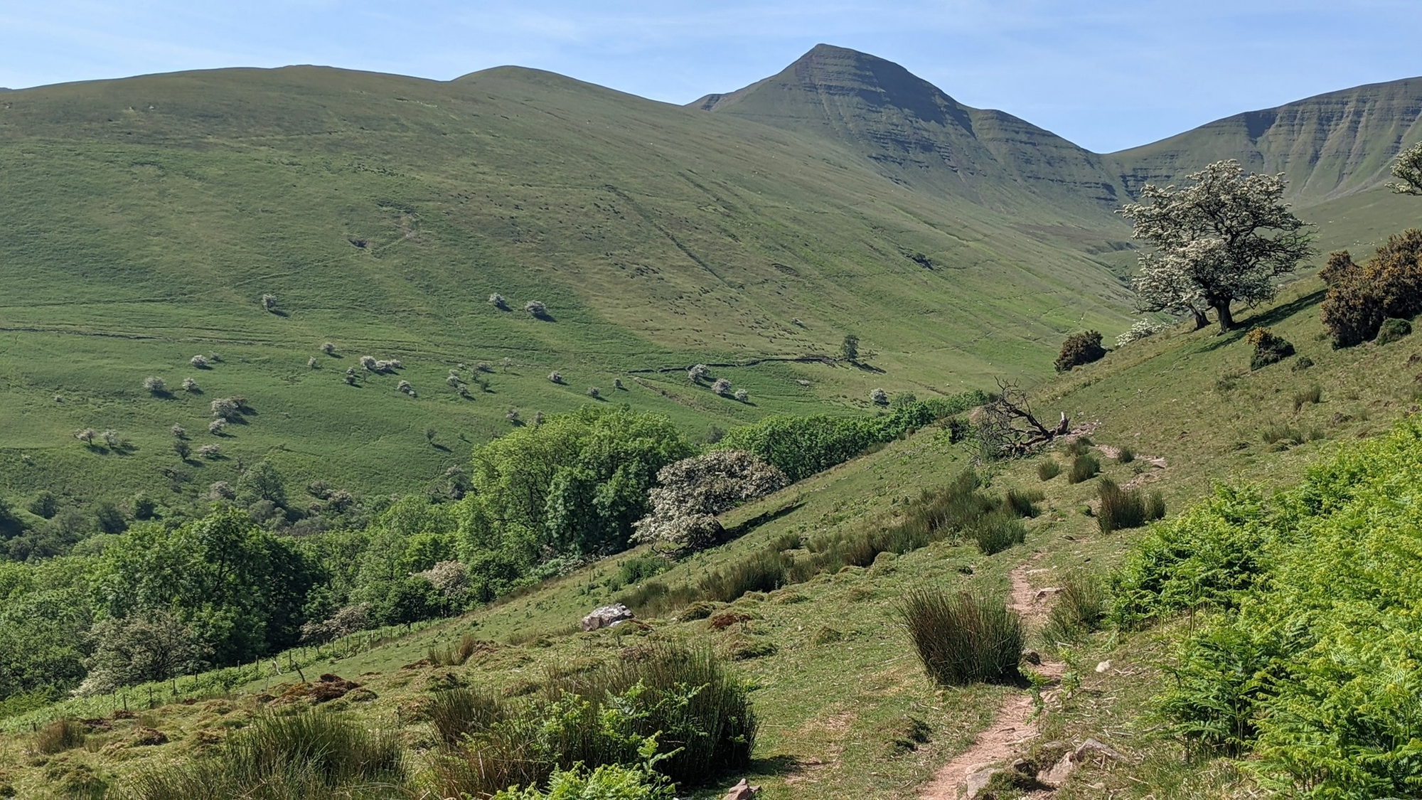
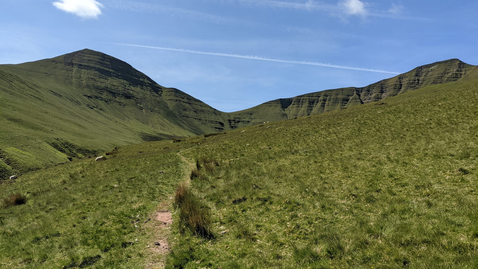
The first difference was that today I was in shorts and T shirt, which hadn't been my choice of attire for the March walk. I managed to get out of the car park unassisted today, which felt like a good omen. The first part of the walk involves skirting the foot of a hill before gently ascending to join a path along the valley wall.
I remembered this as being relatively easy, but now the vegetation was much higher. Hidden within the vegetation were stinging nettles. Remember I'm wearing shorts...
I was genuinely surprised at how overgrown the path was, and just after negotiating a fallen tree I took a short break to drink some water. Just as I was picking up my rucksack, I noticed another path running parallel to mine, about 3m away. It was about a metre wide, no overhanging vegetation and no stinging nettles. I swapped paths.
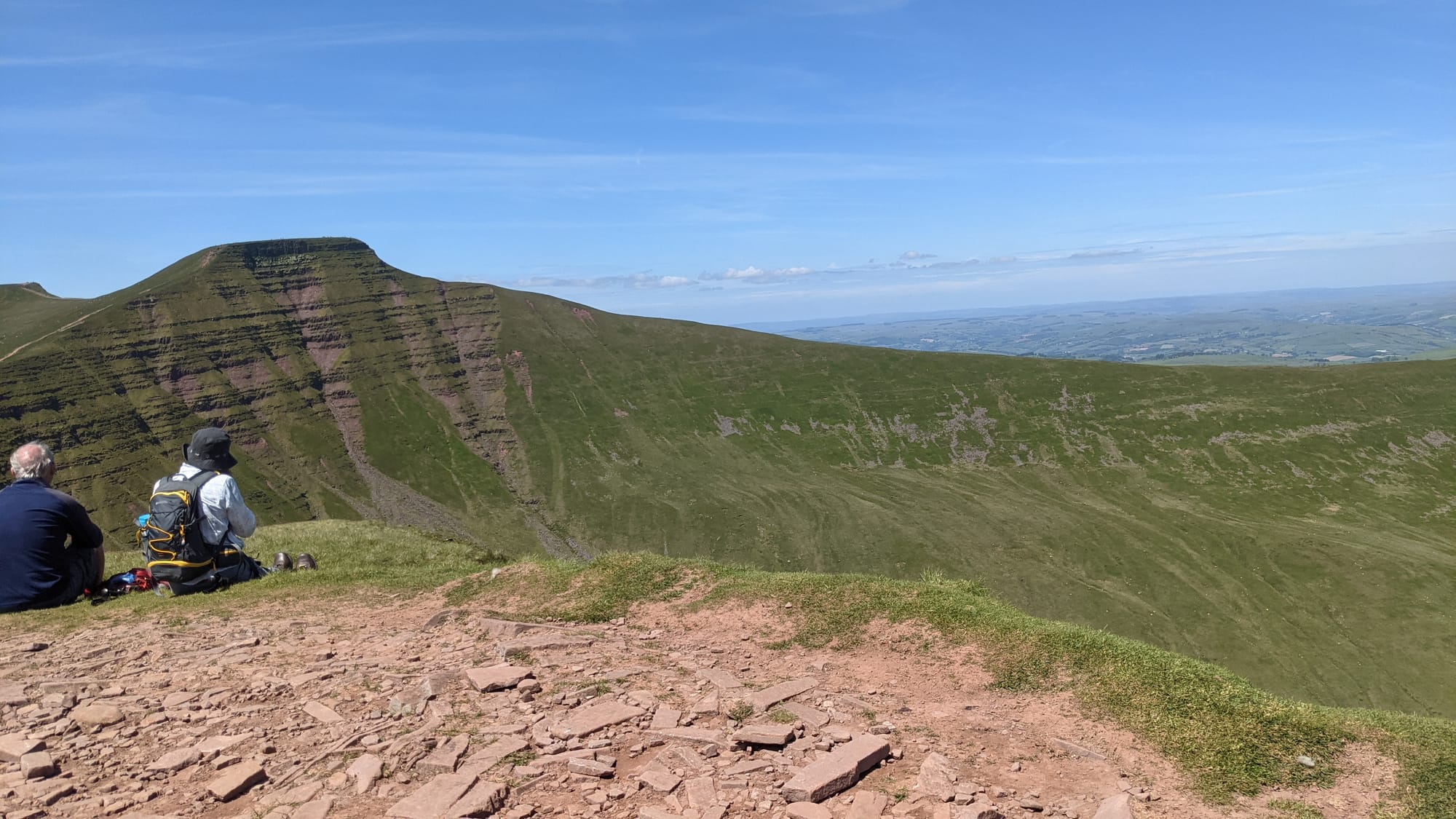
I was now walking along the right hand side of a blind valley. To my left at the bottom of the valley was a stream with the valley wall rising on the other side,. Ahead and to the left was mountain Cribyn; ahead and to the right, Pen Y Fan.
I had three big climbs to do: the opposite valley side, Cribyn and PYF.
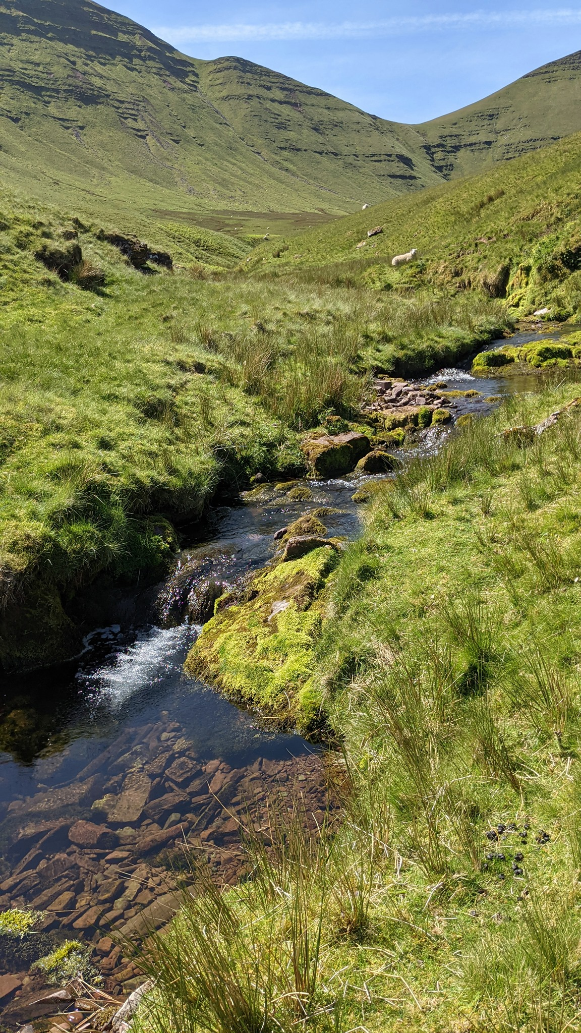
Moving on ahead, a relatively easy walk with fantastic views all round. Temperature was 15C, so comfortable. After a mile and a half along the valley, I descended to the stream.
I needed to cross the stream, which wasn't too hard - it wasn't that wide, and there were stones to step on. Nevertheless I was careful, and crossed without incident. This differs from my March 2019 crossing when I fell in.
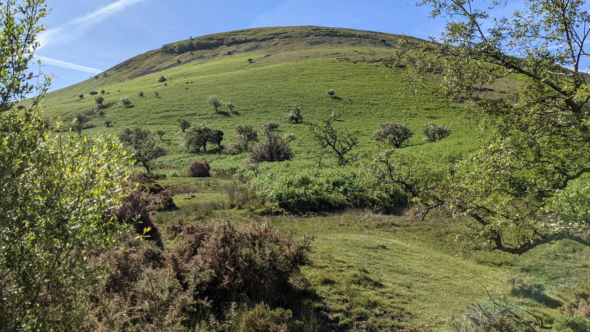
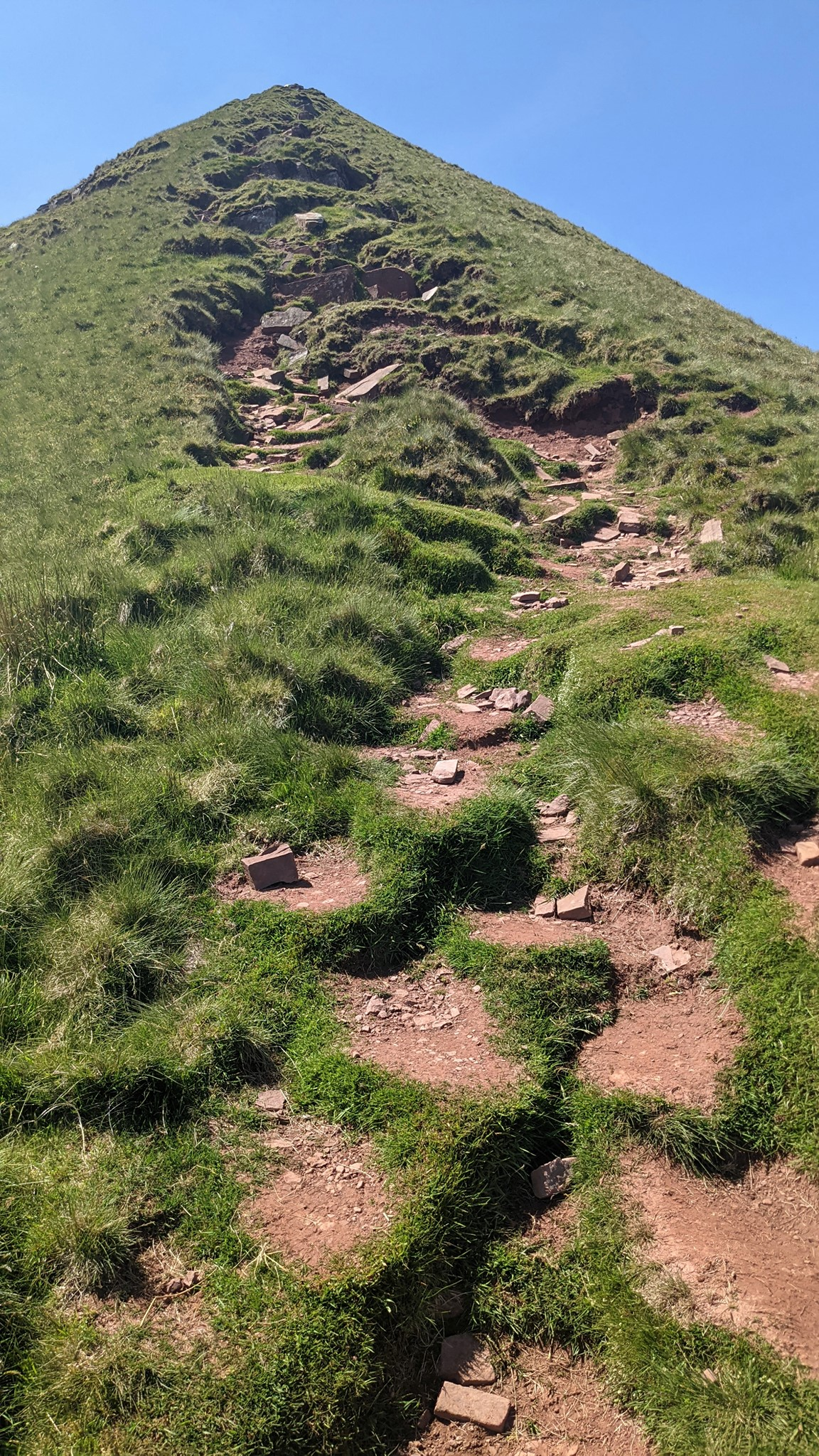
First big climb: up the valley wall. The hill is convex: the more you climb, the more appears. It took me half an hour to climb, including a 5 minute break to reflect on the wisdom of my holiday choices.
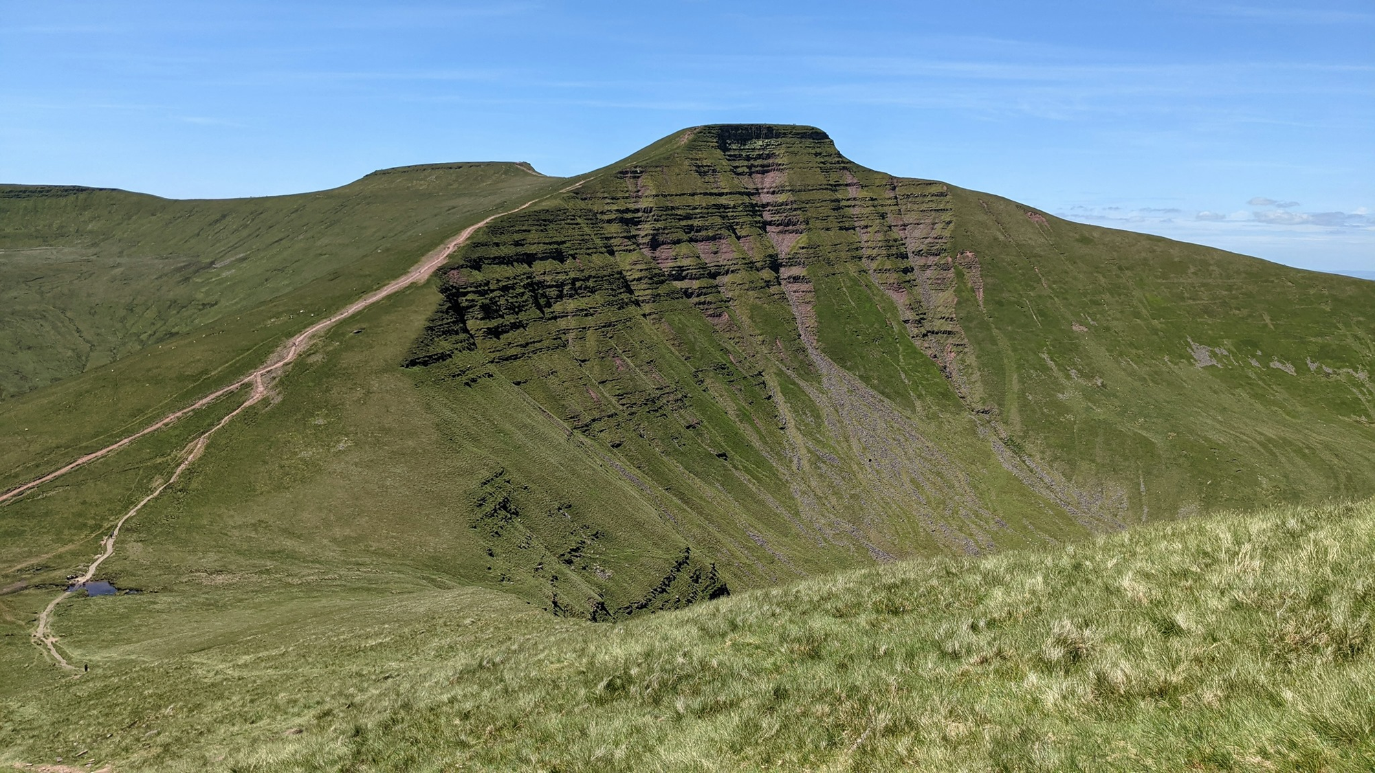
Shortly ahead: Cribyn. There are many ways to describe how steep the climb up Cribyn is, but my mother will probably read this so let's settle on the wholly inadequate "very".
I passed a couple coming down as I was going up, and we agreed between us that coming down wasn't much easier than going up. They had a Yorkshire Terrier with them who insisted on demonstrating how easy it was when you a) have a low centre of gravity; b) have four legs; c) aren't 62.
But the view from the top was spectacular. Apart from the couple I'd passed while climbing Cribyn, I'd see no other people since I started. The top of Cribyn (we serious walkers call it the "summit") did have some tourists who'd come via the easy path. I sat there wheezing for a bit so they'd all know just how bloody hard it is coming up the Proper Way.
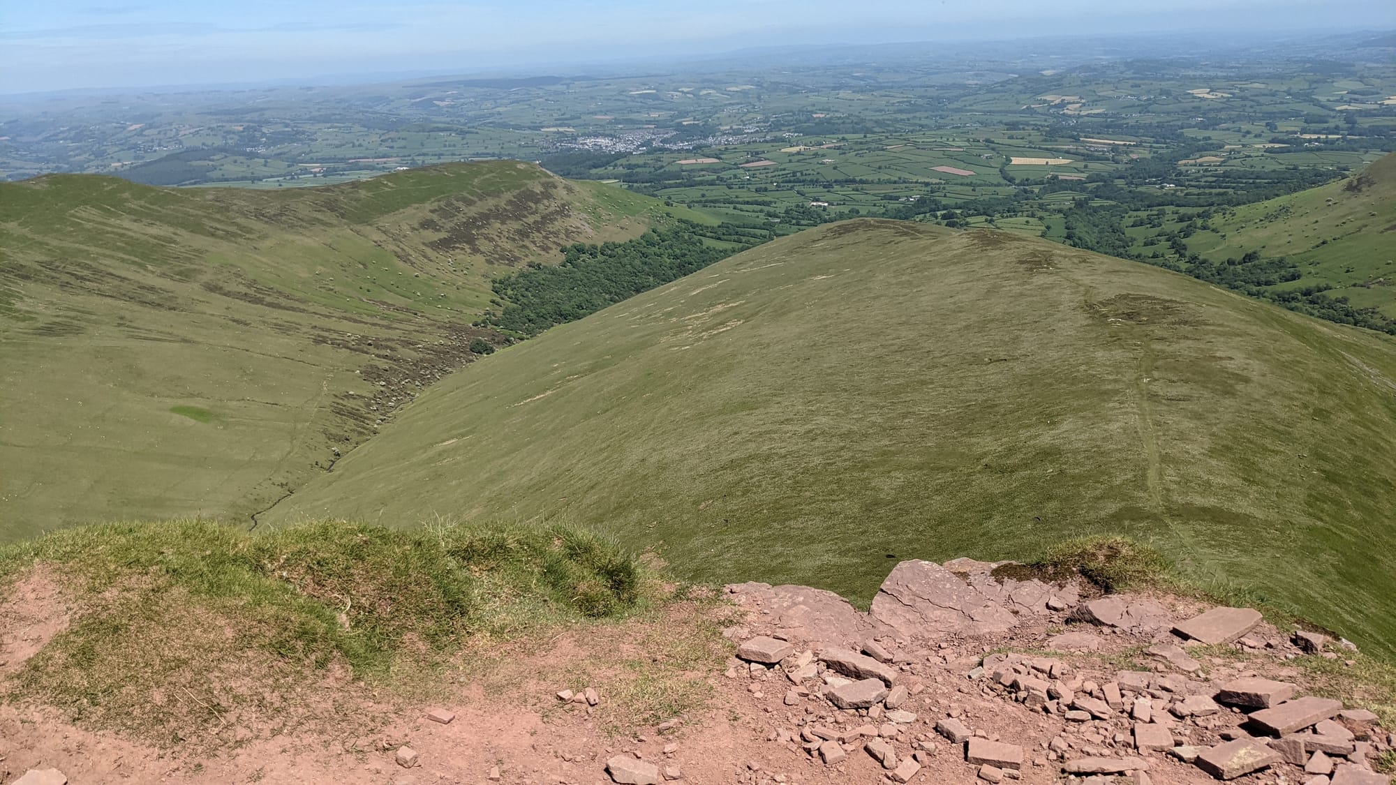
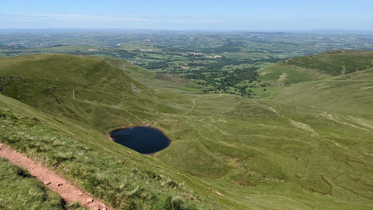
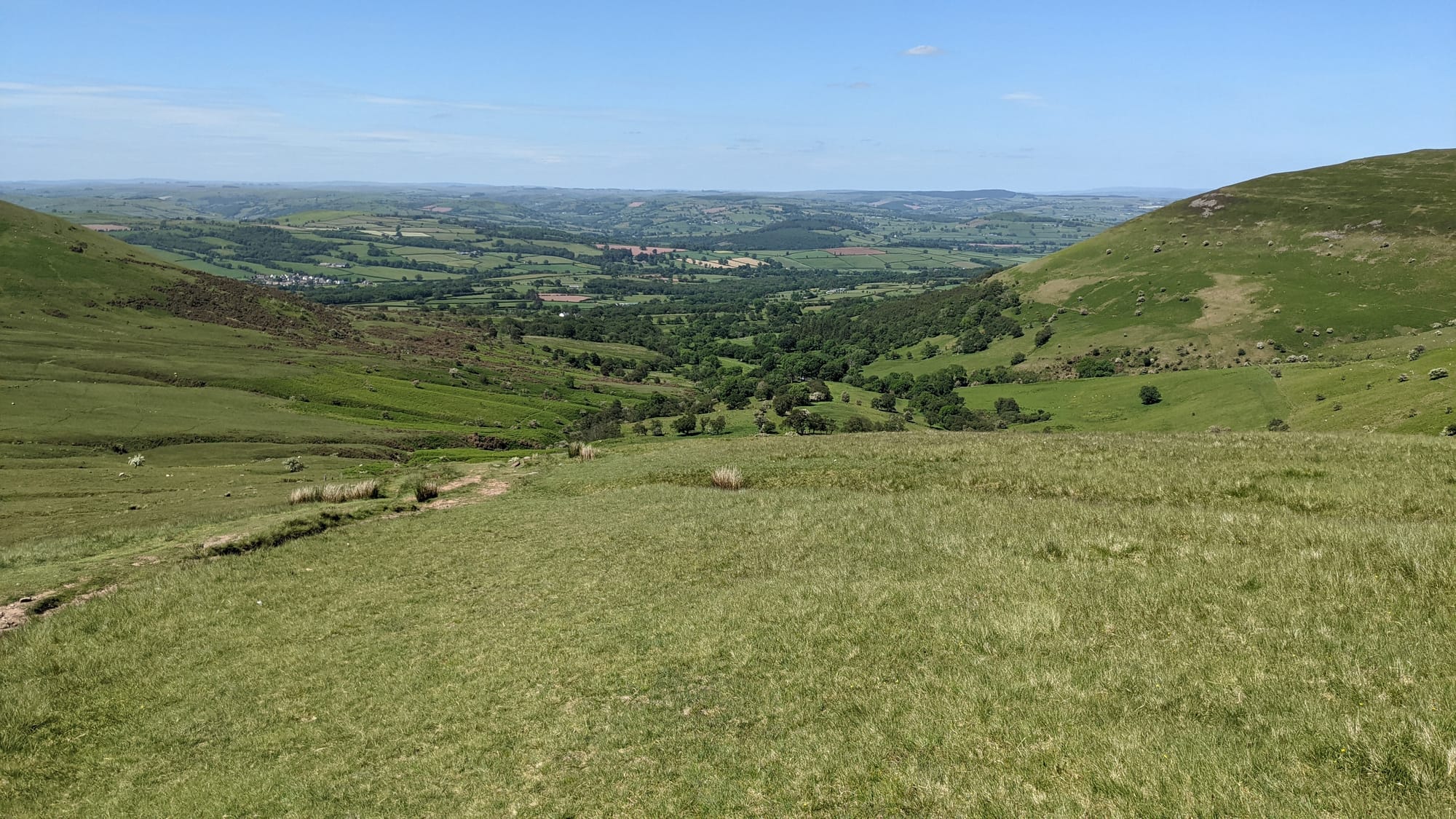
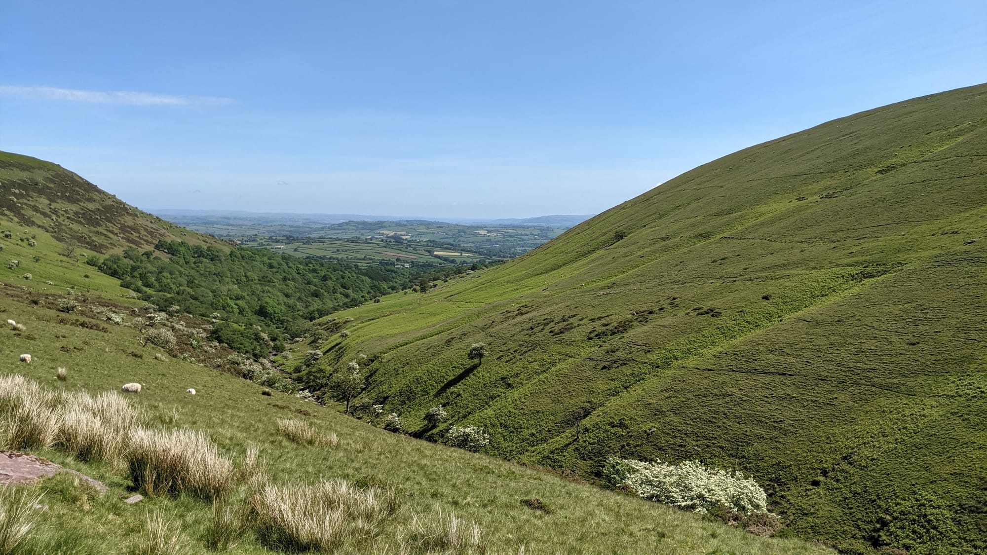
From the top of Cribyn
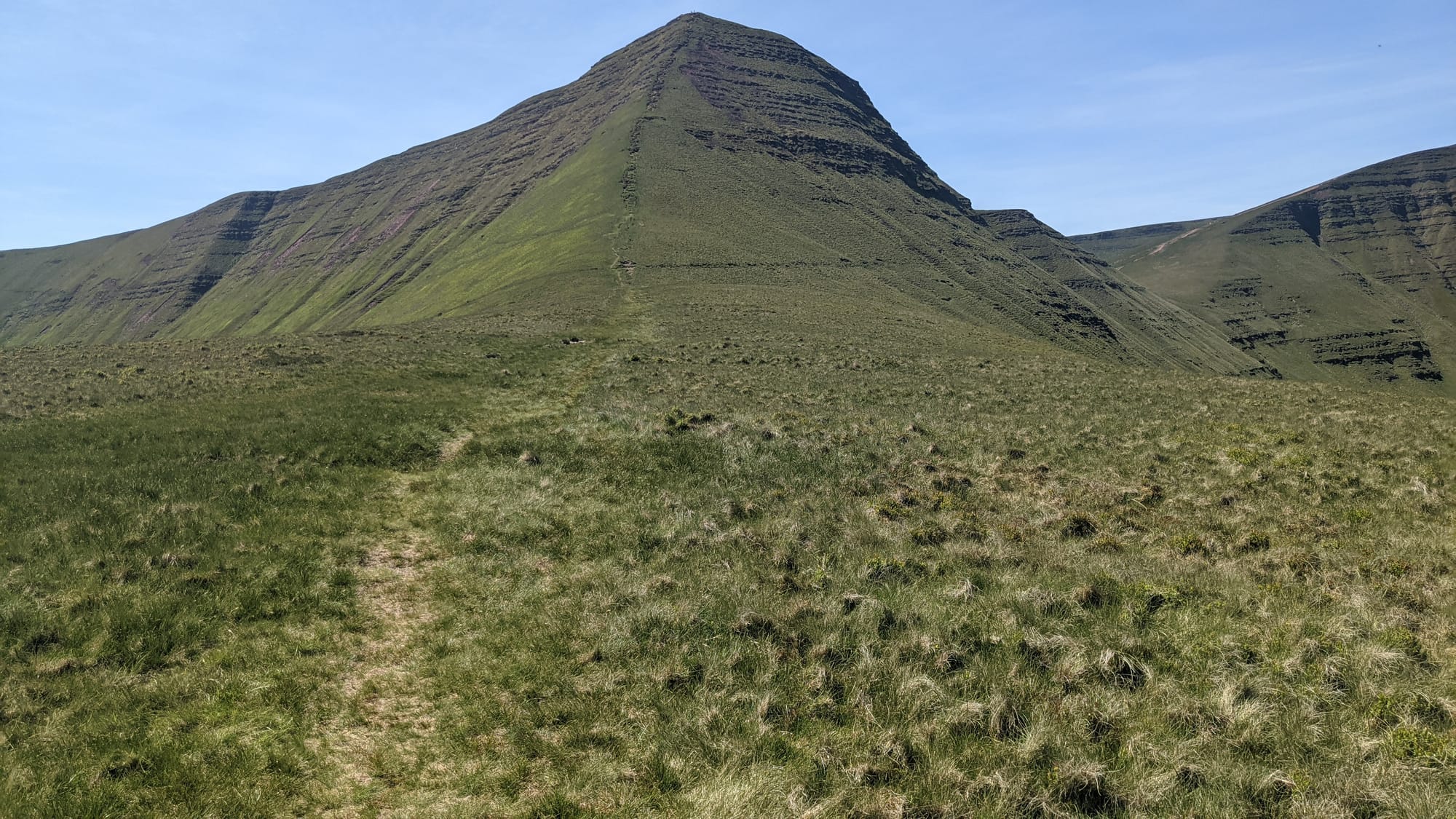
Next a skit across to Pen Y Fan. Annoyingly one descends almost the height of Cribyn only to then have to re-ascend PYF. I took my time on this, the third big climb, but finally got to the to-, er, summit. Fabulous views all round - what do you expect from the highest mountain? - and crawling with tourists. There was even a kind of queue of people wanting to take pictures of themselves next to the sign.
Last time was different. When I reached the summit in March 2019, I think I was the only one there. I say "I think" because the summit was in cloud. It was at that point that I was grateful that I had a) an OS map of the area; b) a compass; c) some idea of how to use (a) and (b). I remember measuring the course of the next path, then tentatively walking though the cloud to edge of the summit - and finding the path!
Much easier this time: I could see it. Quick biscuit break and on my way to the third summit, Corn Du - but an easy walk from PYF.
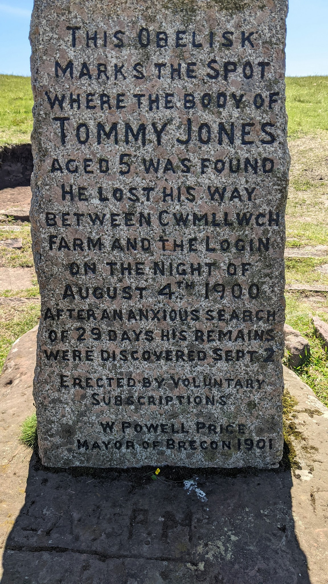
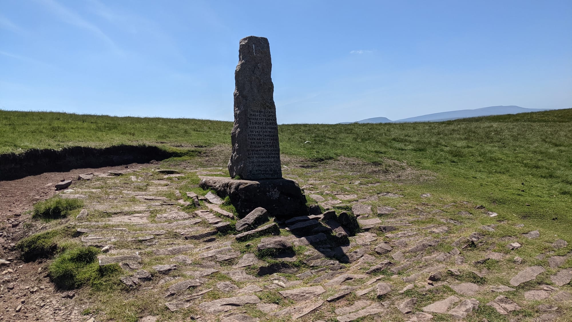
Now to descend, skirting an escarpment and lake. Passed a memorial obelisk to little Tommy Jones who, at the age of 5 in 1900, became separated from his father. The memorial marks where his remains were found. Such a sad story - although if he'd lived, he have been 19 in 1914, which wasn't a great age to be then.
The remainder of the walk was along the valley floor - this valley being one over from the one I'd walked along earlier. Even walking downhill was getting harder: I was getting tired. Finally, level ground and a walk through some woods to a road.
The book said, "[continue along the road] and at a crossroads turn right and follow a narrow lane for one mile [to the car park]. Frustrating walking to the crossroads knowing that my one-mile countdown had yet to start.
Finally reached the crossroads, turned right and walked one mile UP HILL to car park.

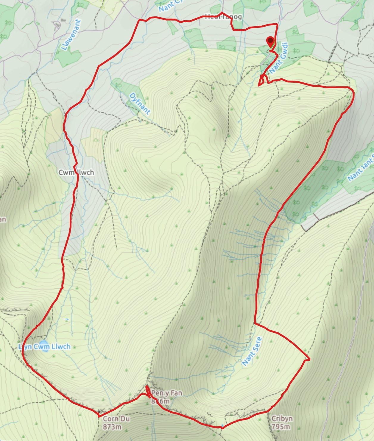
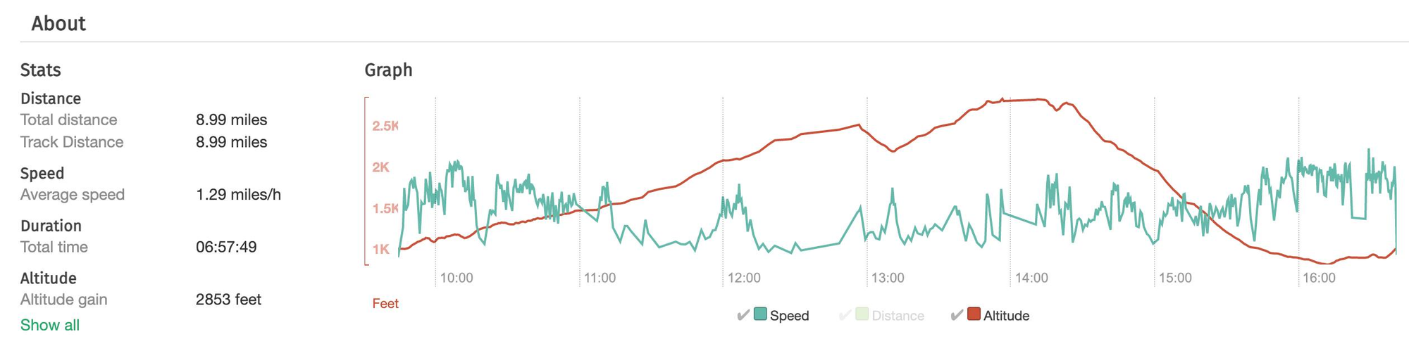
Map and stats
Miles: 9
Height gain: 3052' (not quite a Silver, gliding people!)
Blisters: 1