Cotswolds: day 1
Ah, the Cotswolds: rolling hills, stone houses, aspiring middle classes and home to the Cotswold Lion which, disappointingly, is a breed of sheep. I'm here for a week of solitude, walking and thinking, the latter being a much-underrated (and, at times it seems, rarely exercised) activity.
I'm accompanied by my Pathfinder Guide of Cotswolds Circular Walks. As I sat in my little rented cottage last night, studying it to identify the first day's walk, I noticed that one of the walks went past the front door of the cottage. That seemed easy: day one walk chosen.
The forecast was for good, warm weather. I stepped out of the cottage at 09:15 and it was already warming up. A quick reconfiguration from walking trousers to shorts and I set off.

Even in the tourist-popular Cotswolds it's easy to be out of sight of fellow humans for some time, but I did stop to chat to one lady walking her two dogs. I asked how old the Labrador was. Turned out she was a Labrador-Pointer cross, 7 years old, She'd been wild in the house for the first couple of years so they bought a second dog. A moment of desperation, I suspect, but it worked. Both dogs calm. We talked about puppies for a bit and I told her about Roxie, our three month old Labrador bundle of energy, and how we'd had to say goodbye to Rhys, her predecessor, in March. "No home is complete without a dog," was her parting comment. She's right.
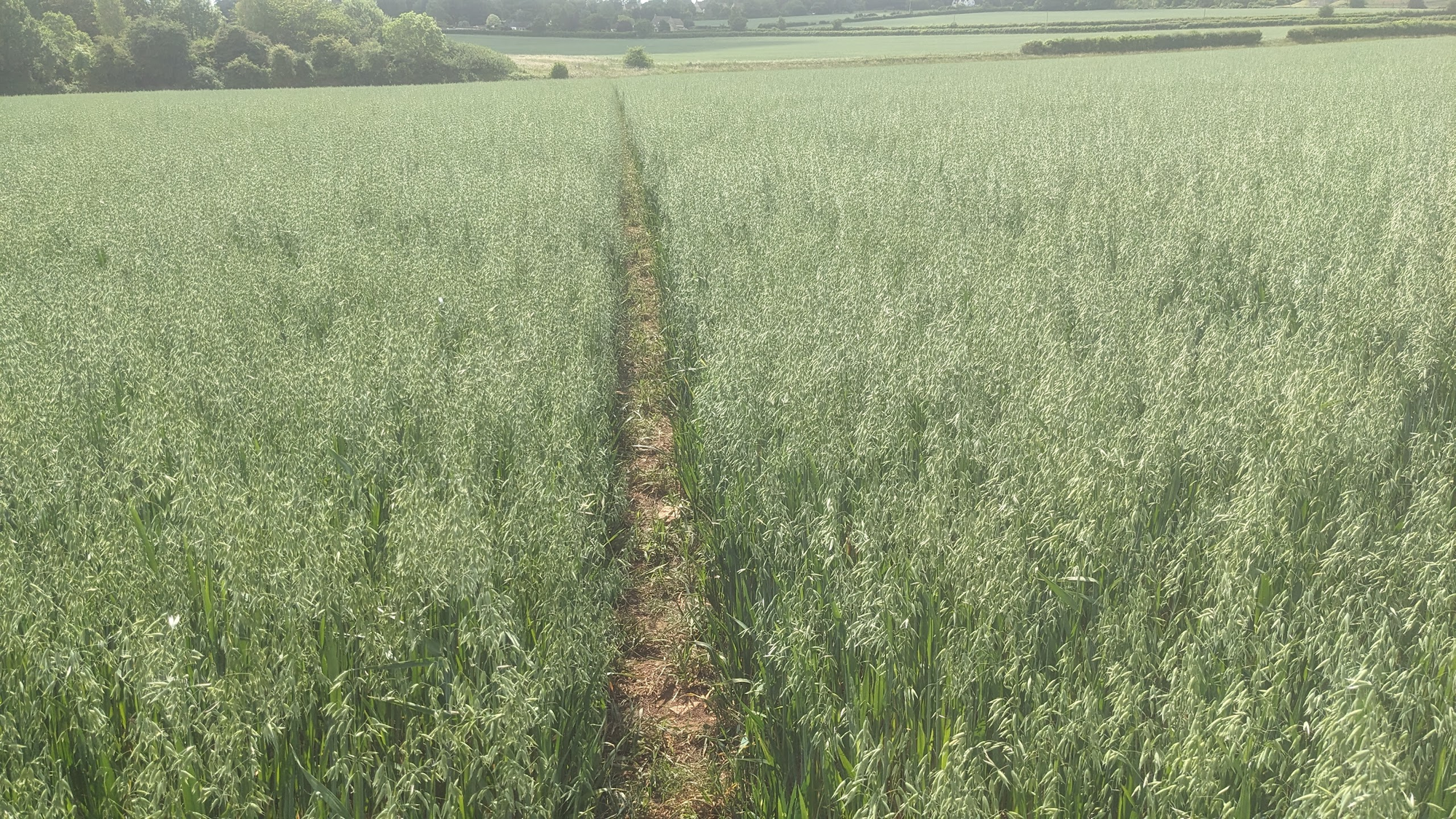
I was heading gently towards Bourton-on-the-Water, which was the original start/end point for this walk. One of the paths across the middle of a field was literally the width of a tractor tyre. I did wonder whether I'd got the right path, but everything looked right so I went with it. I suppose it minimises the loss of crop to a public footpath.
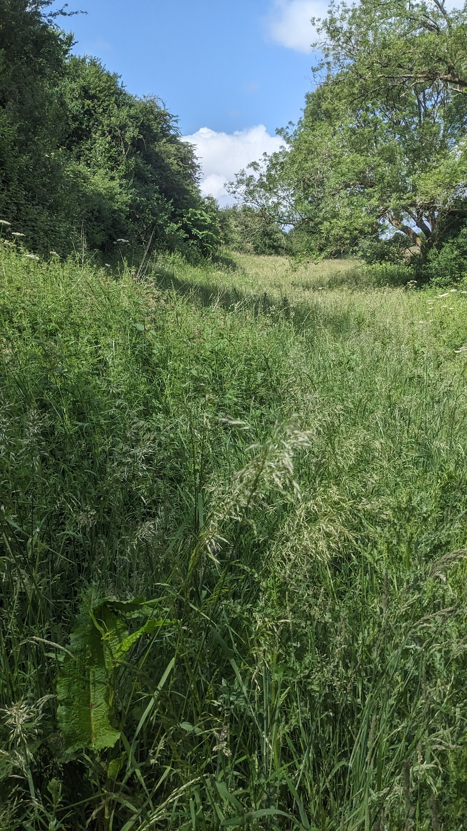
The paths were mostly good, but at one point the guide book did mention that the path "may not be visible". The fact that, at that time, I couldn't see any path wasn't quite as reassuring as one might like.
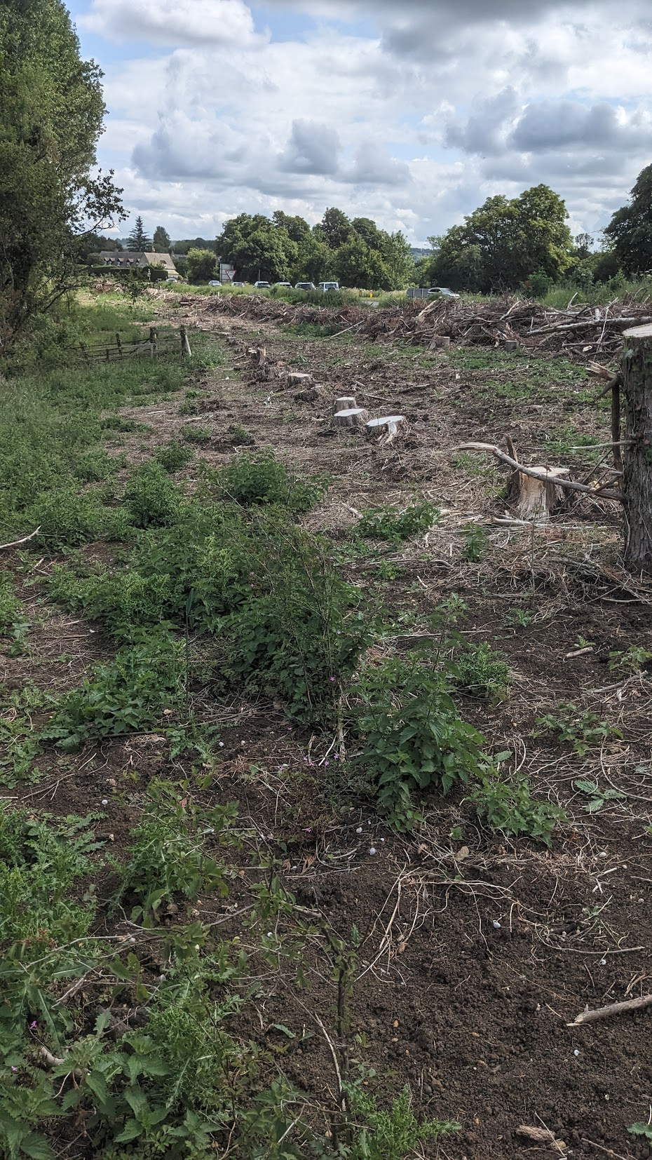
Soon after that I was supposed to have a river on my left and a row of poplar trees on the right. Now poplar tress are pretty tall and distinctive, but there was no sign of them. Maybe my invisible path wasn't actually there? Such existential thoughts were quelled a little further along when a row of tree stumps looking suspiciously poplar-like honed into view.
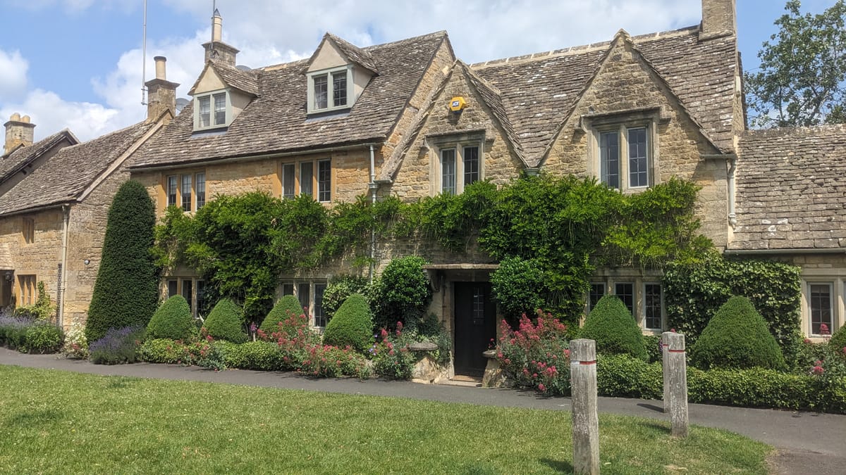
I was approach Bourton-on-the-Water now. BotW is a well known and pretty village, but it's well known-ness means it's popular. Today was Sunday; the weather was lovely and warm; BotW was crowded.
The centre of Bourton-on-the-Water is the River Windrush, crossed by a number of low stone bridges, some for pedestrians only. The population of BotW is just under 3,500 people but it receives around 300,000 visitors a year. I skipped the car museum and model village. Most of BotW is a designated conservation area. The UK only introduced conservation areas in 1967. We may not be perfect, but I'm grateful we try to protect these places.

I bought a coffee and sat by the river as one of this year's 300,000. An armada of ducks were paddling furiously along the river with a sense of purpose that - here at least - only ducks have.
Being in the tourist trap I was able to purchase, for only £3.50, a single cone of salted caramel ice cream. It bore no resemblance to either of the flavours it was named for (nor anything else that I could detect): disappointing. Time, in fact, to leave BotW and press on.

Next on the agenda were the Slaughters, first Lower and then Upper. They're odd names, sounding like something from a horror movies (An American Werewolf in London, anybody?). The name apparently derives form the Old English term "slough" meaning "wet land". Wet, one hopes, with water.
Lower Slaughter is a beautiful village. More charm than Bourton and significantly fewer people, and it has a mill. What more could one want? Well, a proper salted caramel ice cream would have been the icing on the cake, but 'twas not to be. Onwards and upwards to Lower's Upper sibling.
It's not far to Upper Slaughter, and that Slaughter is nice too, but it lacks the charm of Lower Slaughter (my guide book describes it as "much more sleepy", which is significantly more polite).

My guide book is good, but of course the landscape changes over time. What was a style when the book was written may now be a gate; a kissing gate may just be a hole in the fence. When the book said, "Pass a telephone box...", I did wonder but sure enough there was one standing, now repurposed as a defibrillation station.
That sentence continued with, "...and then veer left at the next seat...". Left at a seat? Really?

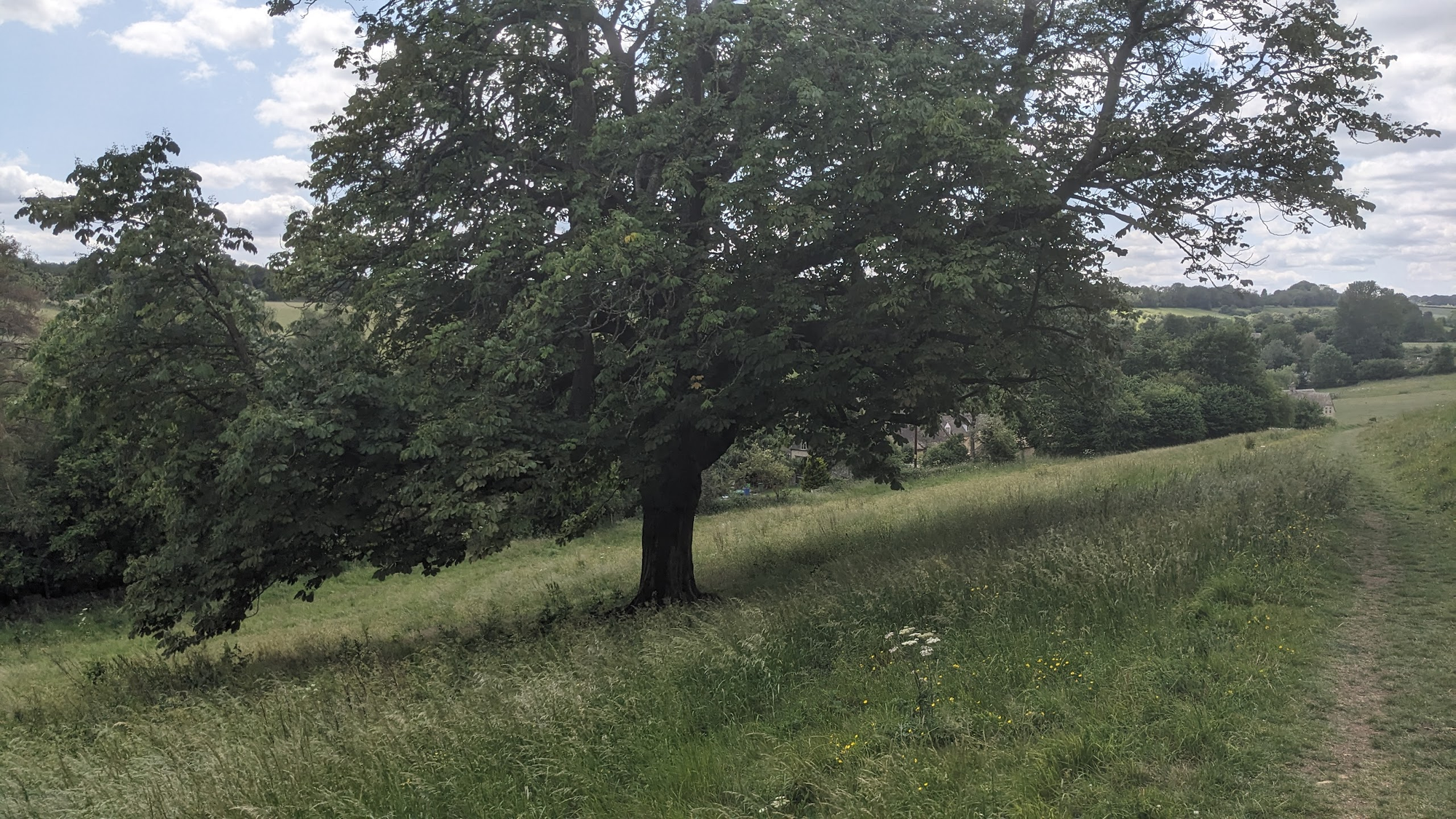
Yes, really. So I went left, and that eventually led me back to the cottage. I passed a tree - a horse chestnut, I think - on the way that was planted on some sloping ground. Interesting how the lower branches are parallel to the ground, don't you think?
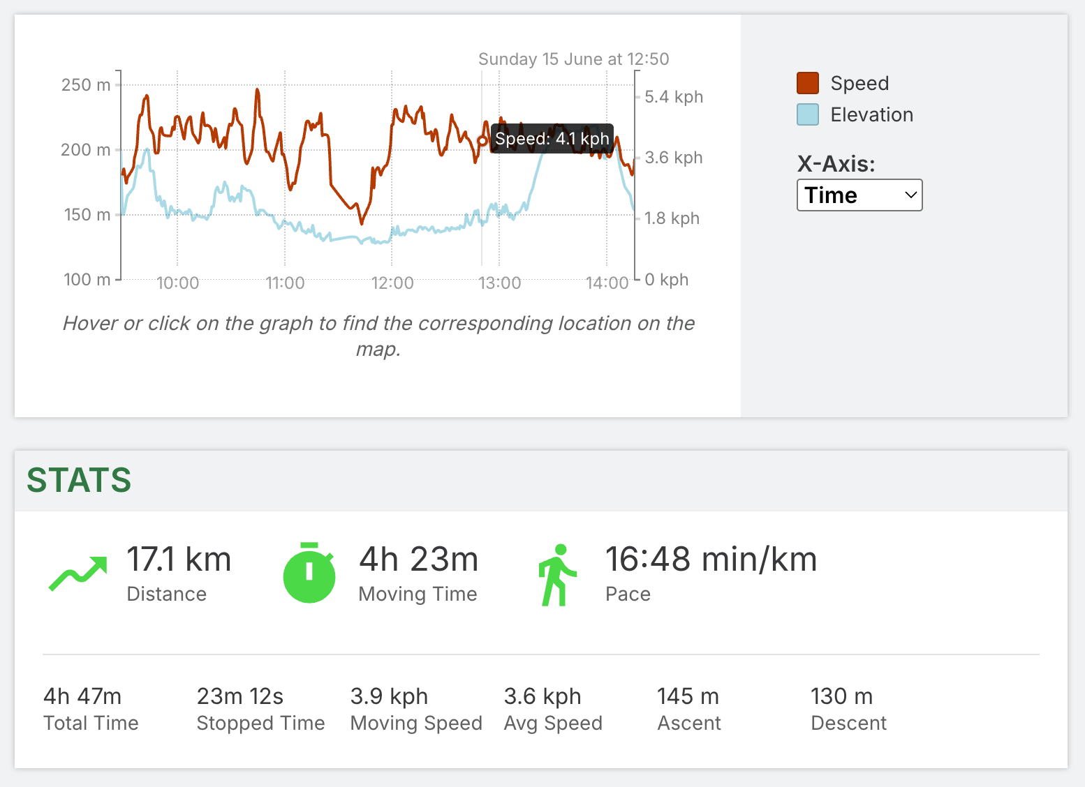
Map and Statistics